Borders of Plurality
exploring Urban Regeneration through Machine Learning
Academic
with Raffael Stegfellner, Oliver Hamedinger
with Raffael Stegfellner, Oliver Hamedinger
published in “Re:Action” (book, Birkhäuser, 2024)
exhibited at Angewandte Festival, 2022
exhibited at “Wien>AI”, Zentrum Fokus Forschung, 2023
published in “Abstrkt: Issue 4”, 2023
published on Dezeen, 2023
exhibited at Angewandte Festival, 2022
exhibited at “Wien>AI”, Zentrum Fokus Forschung, 2023
published in “Abstrkt: Issue 4”, 2023
published on Dezeen, 2023
Our cities are symbolic in their manifestation of today’s inequalities. Throughout the last century, policies have created urban fabric that is increasingly homogenous in form and function. Programmes and typologies have been deliberately separated and the public and natural realm in-between has been continuously more controlled in the name of transportation, safety and surveillance. These urban typologies are not only socially unsustainable, they are also unequipped to provide radical solutions to changing environmental concerns and the reality of an imminent climate crisis.
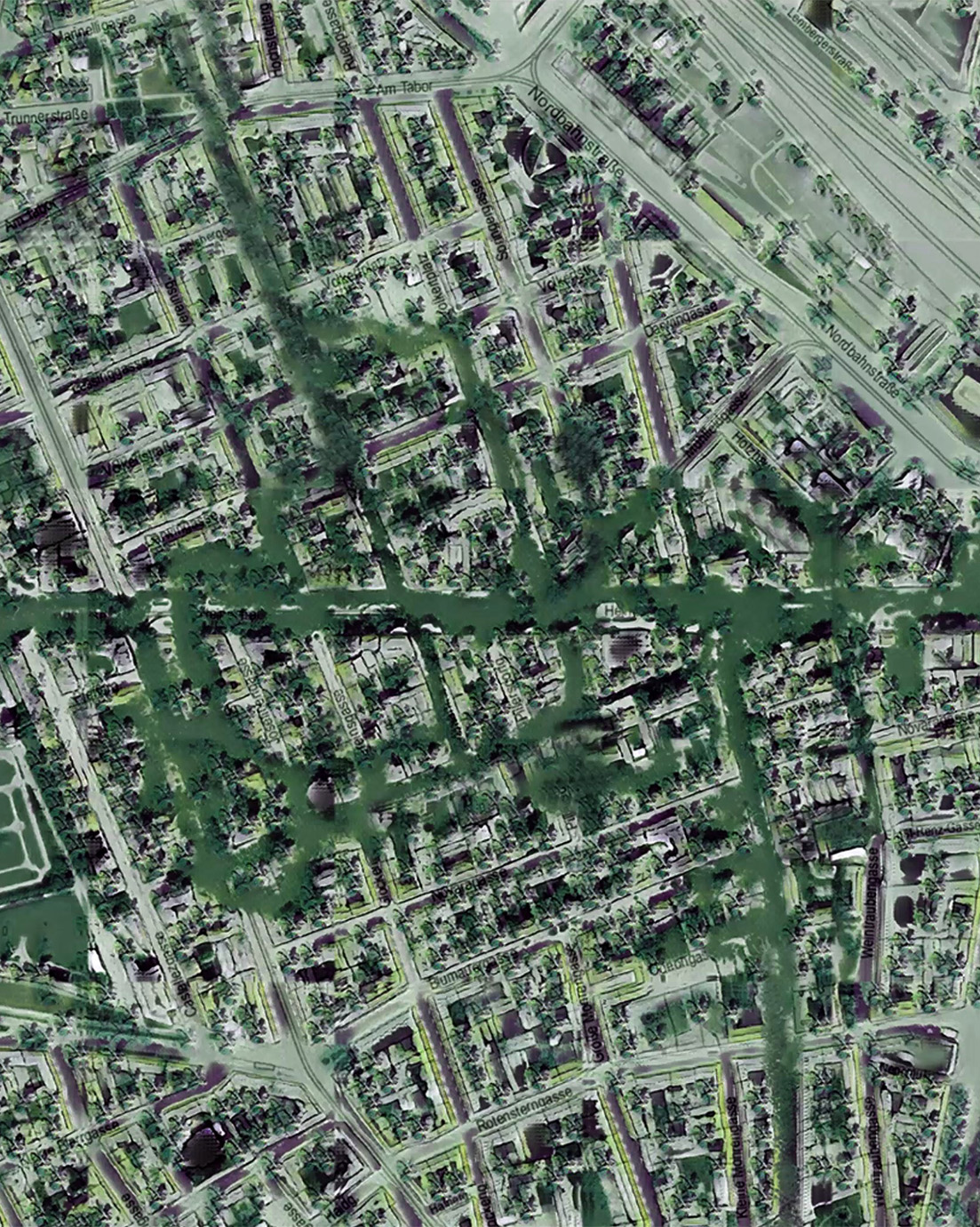
Borders of Plurality uses Machine Learning techniques to reimagine Vienna as network of green corridors, opposing the hazards of overheating and species extinction by an increase of biological agents. By analyzing existing neighborhoods in Vienna, the project marks areas within the city that are unequipped to withstand changing environmental conditions and are socially unsustainable.
Through thorough classification, zones are determined in which a regeneration takes place. Instead of overriding existing contexts, the main goal is to utilize as much as possible from existing structures, dismantling buildings partly but keeping their skeletons. Machine Learning networks trained on historic cartography and imagery provide first hints for the urban reconfiguration and regeneration. To reinhabit this framework, clues derived from environemtal data and mappings are translated into transformations to the cityscape.
Questioning the spatial politics of finite lots and perimeters, the proposal speculates on zoning derived from environemtal data and biologic necessity, calling for a paradigm shift in urban planning.
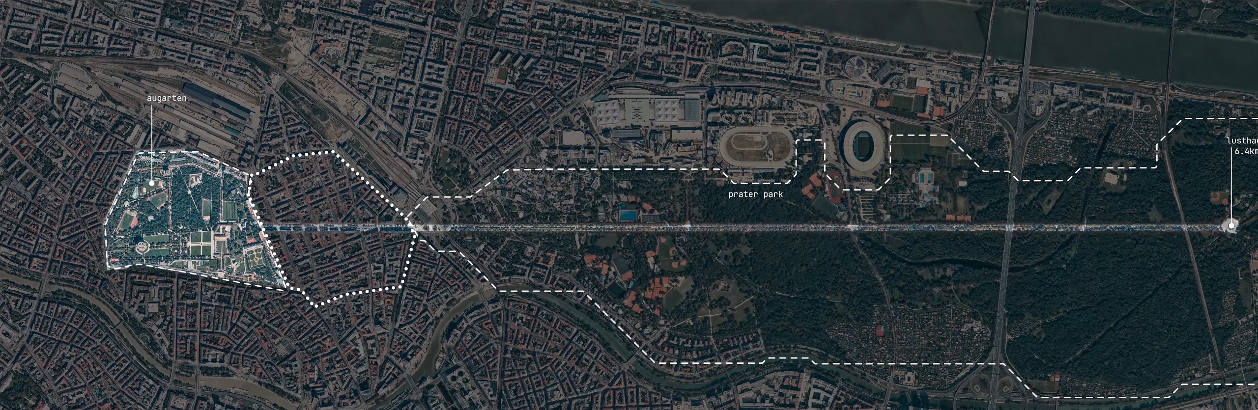
Related: Augarten Dreaming
Contextual Convergence
Oppressing the Natural
Human settlements have become increasingly controlled in order to fulfill economical needs, pushing natural agencies further out. Vienna is now facing a disequilibrium with severe societal and environmental drawbacks.
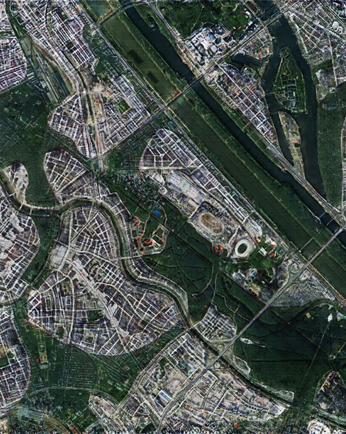
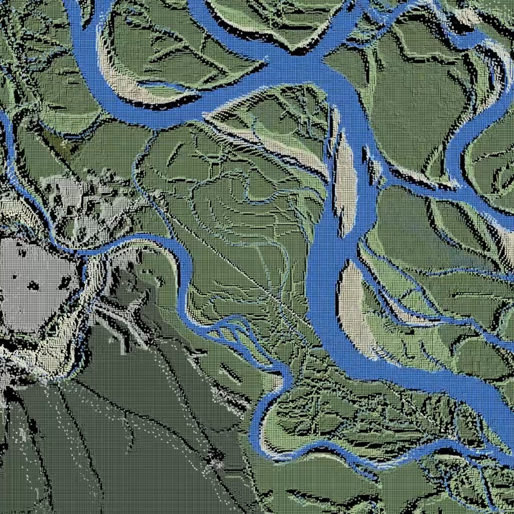
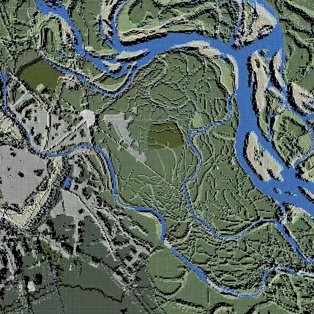
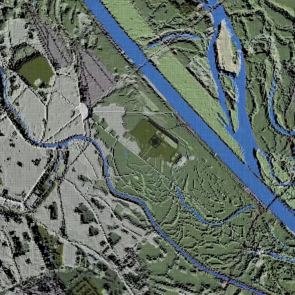
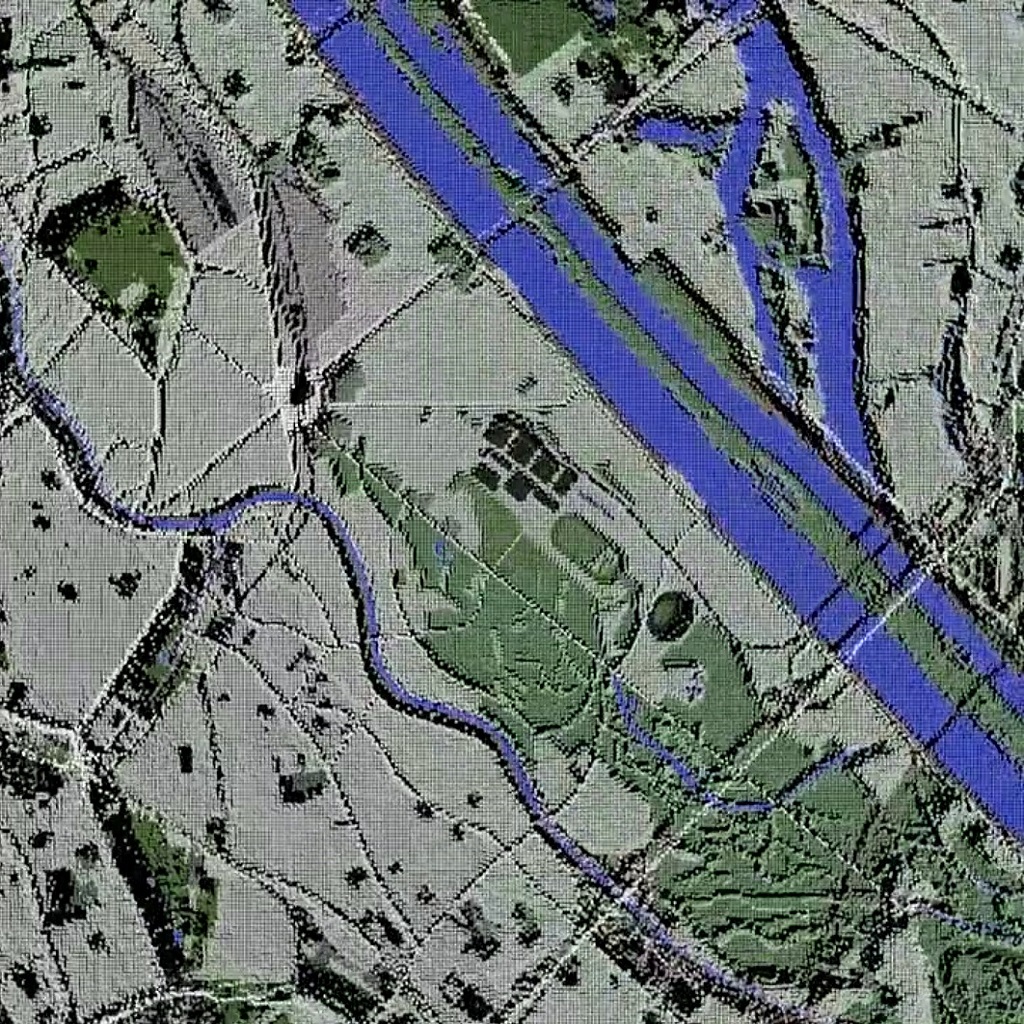
Historically a city wrested from nature, old maps were reconstructed documenting the terraforming process of vast wetlands into today’s configuration. Extended by frame interpolations, a Dataset was created inheriting the properties of zoning.
The trained GAN was then linked to a Style Transfer network, enabling to reimagine the stylized maps as Satellite Imagery.
As an ecocentric approach, the aim is to create urban compositions meant for coexistance and synergy of a multitude of human and non-human agencies, redefining coexistence.
Zoning of past centuries has transformed cities into islands of singular function. A decentralized approach is needed, able to dissolve the strict borders of singularity.
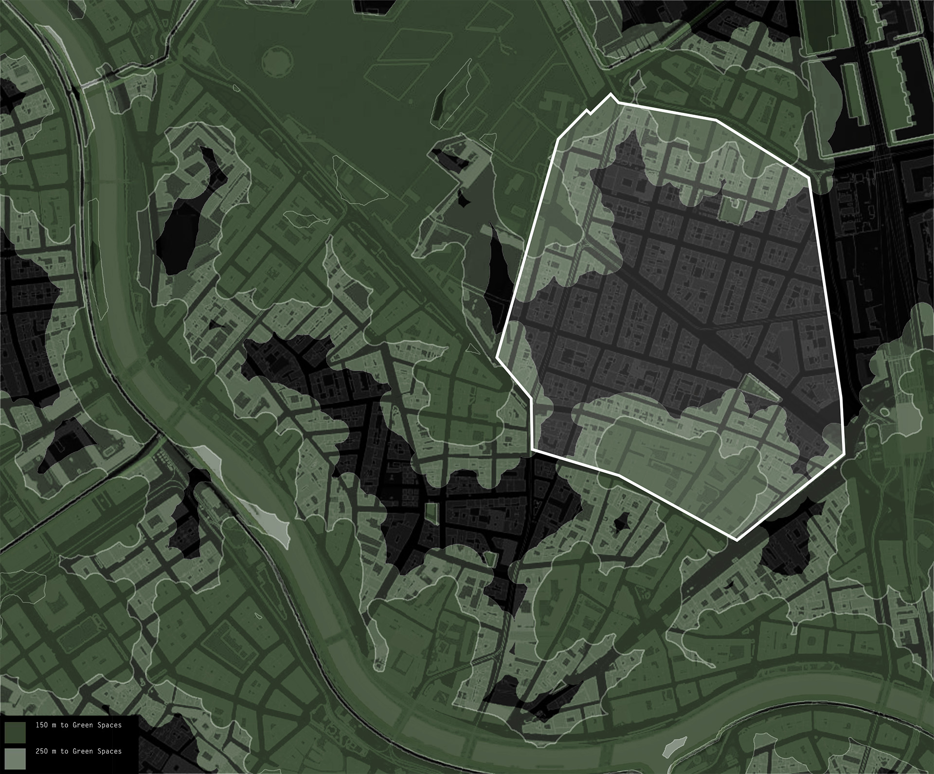
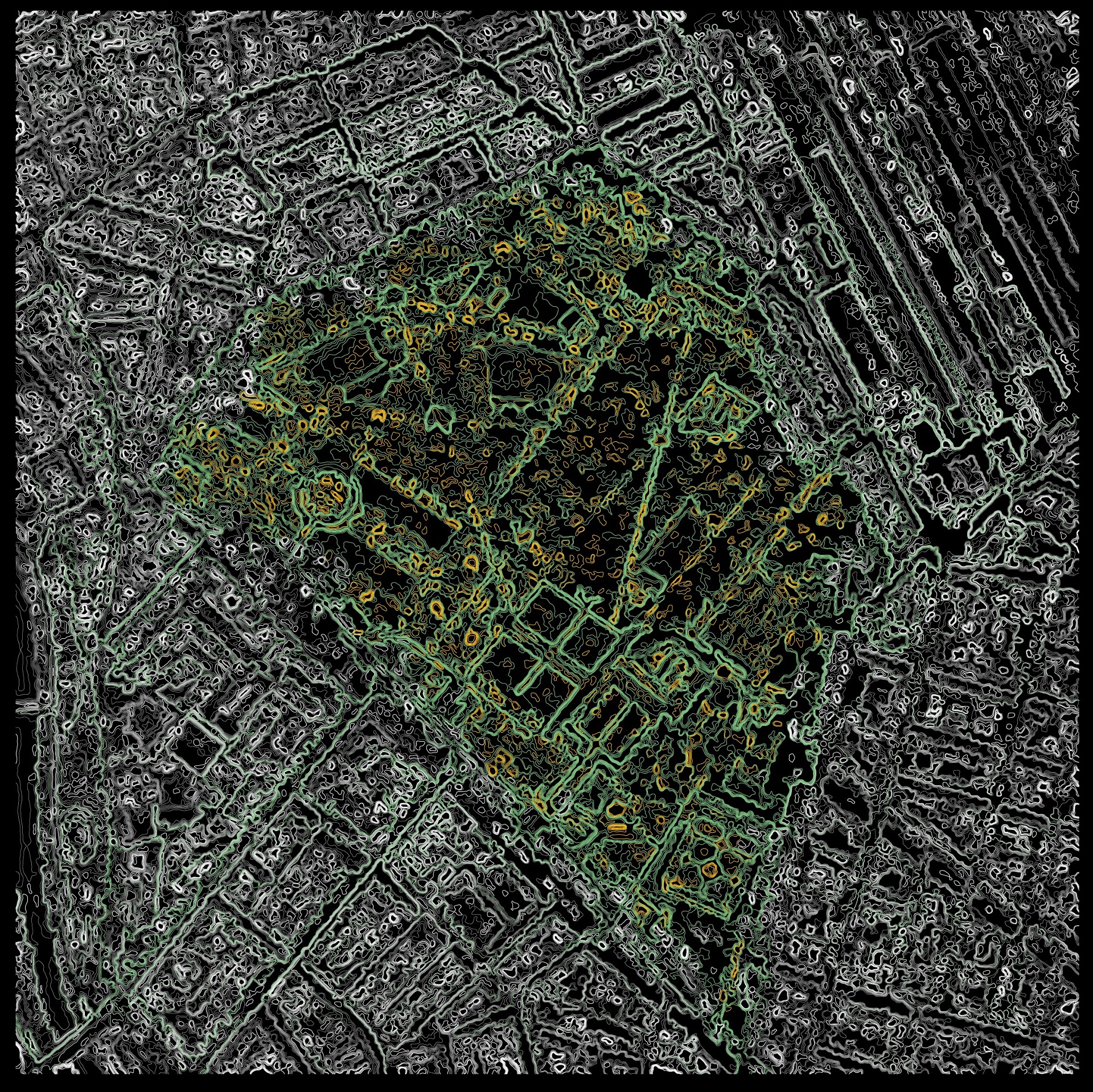
A wider analysis of Vienna reveals the uneven distribution; greenery is domesticated in designated park areas leaving inbetween spaces particularly vulnerable to climate affections.
Human settlements have become increasingly controlled in order to fulfill economical needs, pushing natural agencies further out. Vienna is now facing a disequilibrium with severe societal and environmental drawbacks.
Historically a city wrested from nature, old maps were reconstructed documenting the terraforming process of vast wetlands into today’s configuration. Extended by frame interpolations, a Dataset was created inheriting the properties of zoning.
The trained GAN was then linked to a Style Transfer network, enabling to reimagine the stylized maps as Satellite Imagery.
As an ecocentric approach, the aim is to create urban compositions meant for coexistance and synergy of a multitude of human and non-human agencies, redefining coexistence.
Zoning of past centuries has transformed cities into islands of singular function. A decentralized approach is needed, able to dissolve the strict borders of singularity.
A wider analysis of Vienna reveals the uneven distribution; greenery is domesticated in designated park areas leaving inbetween spaces particularly vulnerable to climate affections.
Borders of Plurality is an exploration in the combinatory potential of artificial and biological intelligence in the context of augmented design processes. This methodology ultimately aims to create a more dynamic and densely-nit urban composition, which rejects the impermeable tendencies of human settlements to their natural world.
The principle of ecocentrism is a fundamental shift from the highly controlled baroque gardens of Vienna into a much more interdependent relationship of human and non-human agencies. Urban fabrics of the future must be able to dynamically embrace the mutually beneficial coexistence of anthropocene, natural and artificial actors.
The principle of ecocentrism is a fundamental shift from the highly controlled baroque gardens of Vienna into a much more interdependent relationship of human and non-human agencies. Urban fabrics of the future must be able to dynamically embrace the mutually beneficial coexistence of anthropocene, natural and artificial actors.
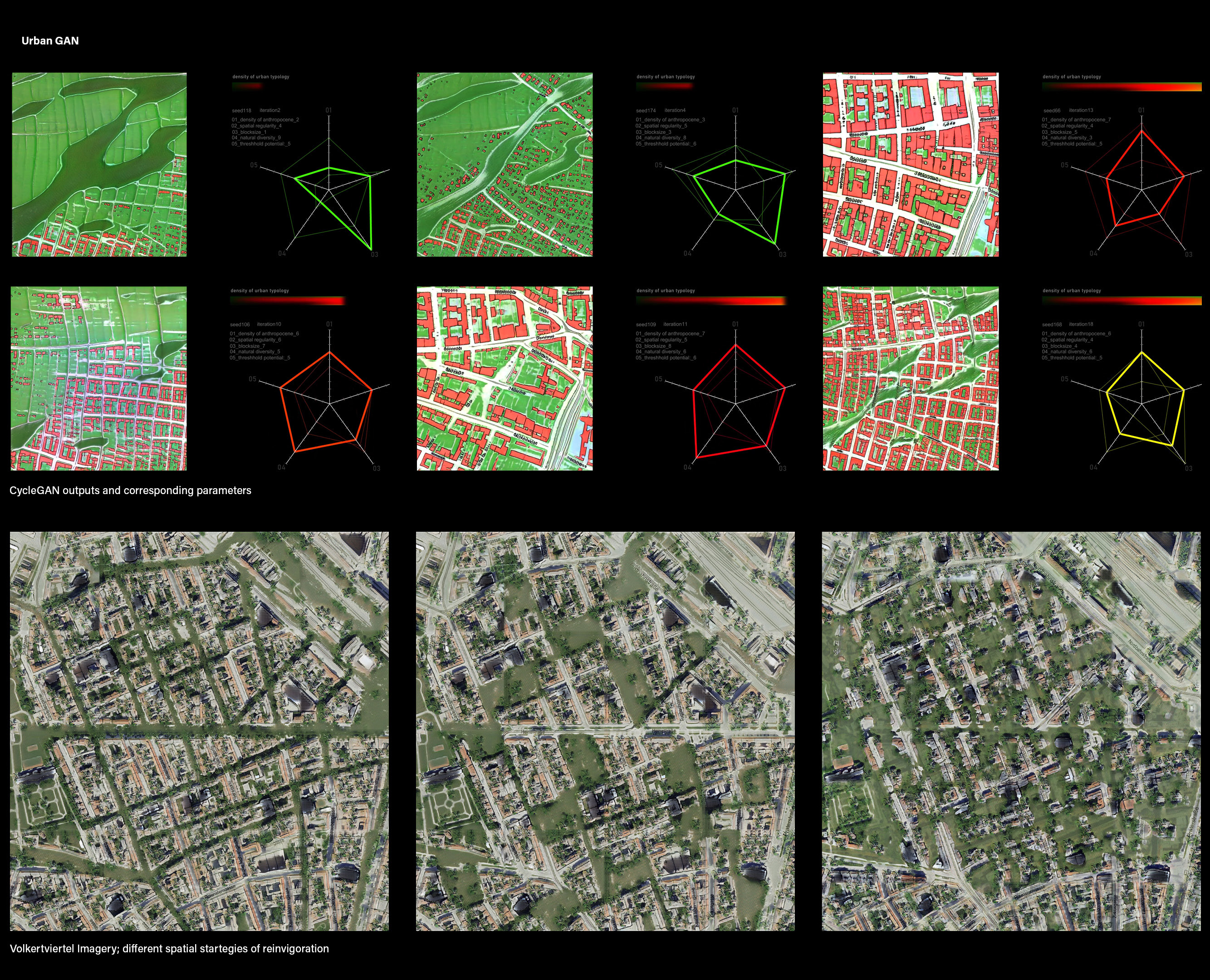
Machine Learning is leveraged in the early project phase as an augmented sketching tool which allows for explorations within the space of infinite solutions along the patterns of Vienna’s urban fabric.
Through supervised learning techniques of feature recognition, the trained network can interpolate through characteristics such as spatial regularity, natural diversity or building density. By again using style transfer, these spatial organization principles were applied to the Imagery of Volkertviertel, testing out different methods and implications.
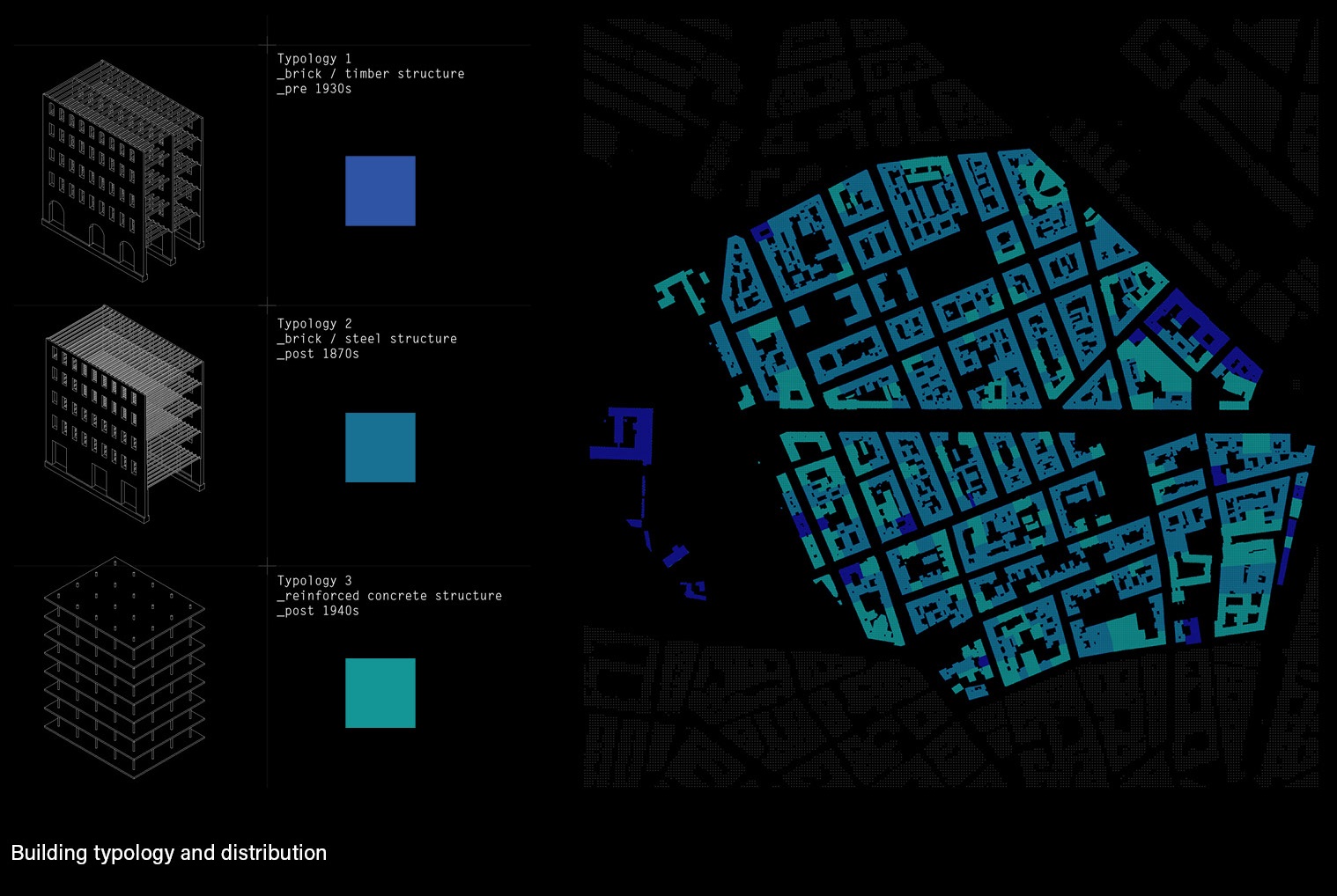
Within this collaborative framework, various of machine learning networks are deployed. Initially, pix2pix architecture is leveraged to disentangle the semantic features of Vienna’s present urban typology.
Through supervised learning techniques of feature recognition, the trained network can interpolate through characteristics such as spatial regularity, natural diversity or building density. By again using style transfer, these spatial organization principles were applied to the Imagery of Volkertviertel, testing out different methods and implications.
Within this collaborative framework, various of machine learning networks are deployed. Initially, pix2pix architecture is leveraged to disentangle the semantic features of Vienna’s present urban typology.
To achieve an authentic balancing of the scales, it is crucial to question the design methodologies which are involved in dictating the development of urban form. All previous planning techniques were conceived solely through the eyes of humans, whose anthropocene preconceptions are therefore inherent in all its products. Through a hybridisation of human and machine intelligence, the act of creation can be extended beyond humanistic instincts into a more open-ended systematic.
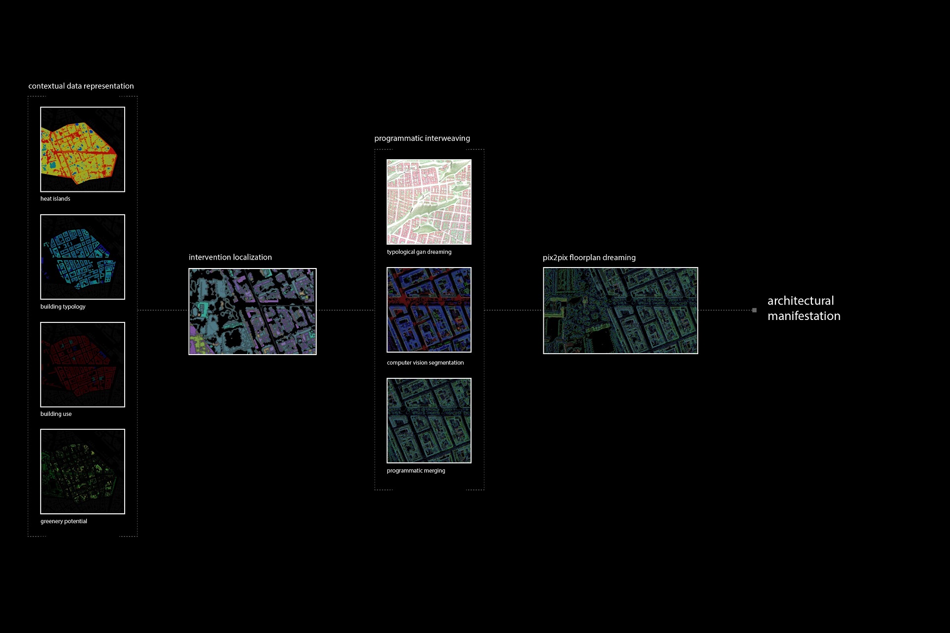

A key advantage of using synthetic intelligence in this context is its ability to reduce the high dimensionality of the complex reality of urban fabrics into a more tangible representation. This generalisation is then passed onto a series of generative networks, which are programmed to explore the depths of all design possibilities within the limitations of the original semantic characteristics.
The potential of this approach is in its visual indeterminacy. The familiar yet strange contradictions present in the outcome create a sensation of defamiliarization, which allow for the viewing of established structures through a different lens. This shift can provide meaningful input in order to produce new and unexpected possibilities of urban compositions.
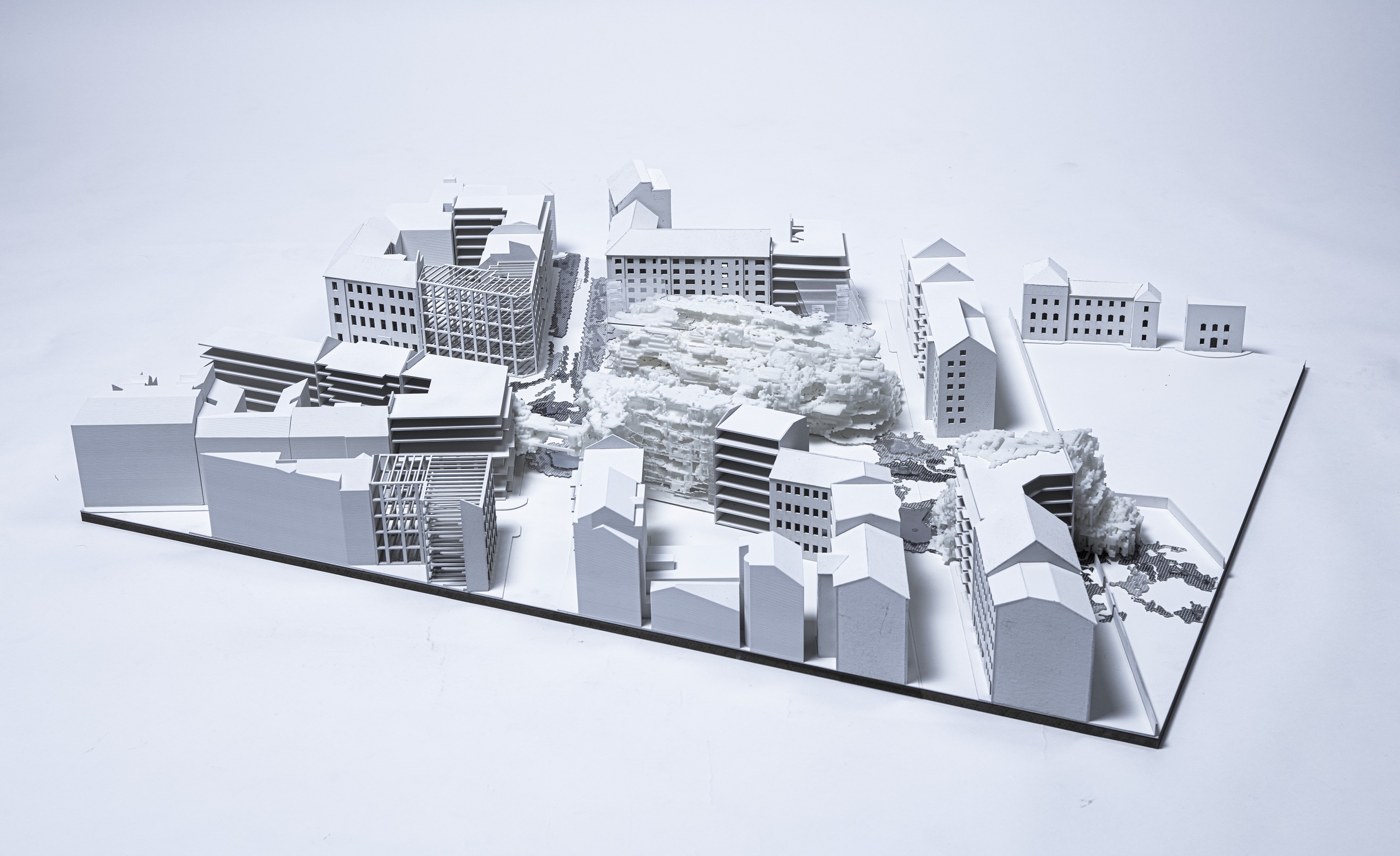
![Masterplan Intervention scale]()
![Contextual Dreaming]()
![Axonometric, Intervention]()
![Contextual Dreaming, 3D-samples]()
![]()
![]()
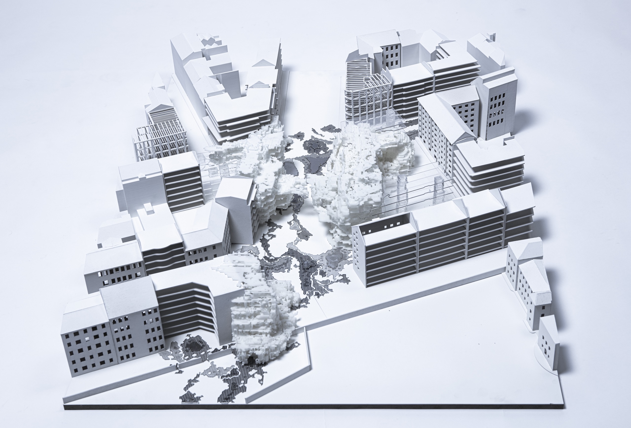
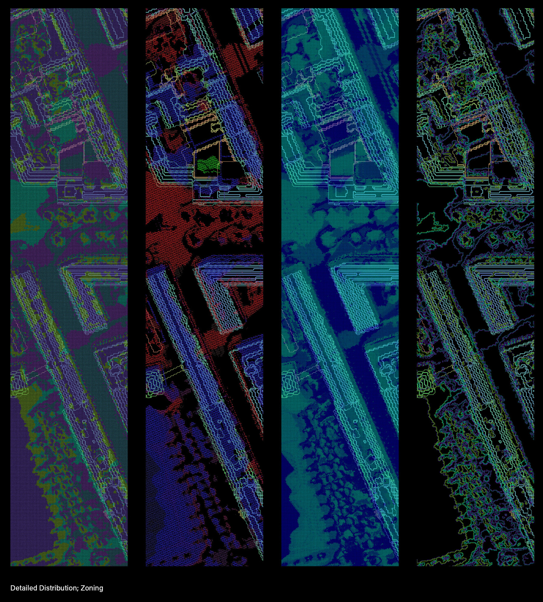
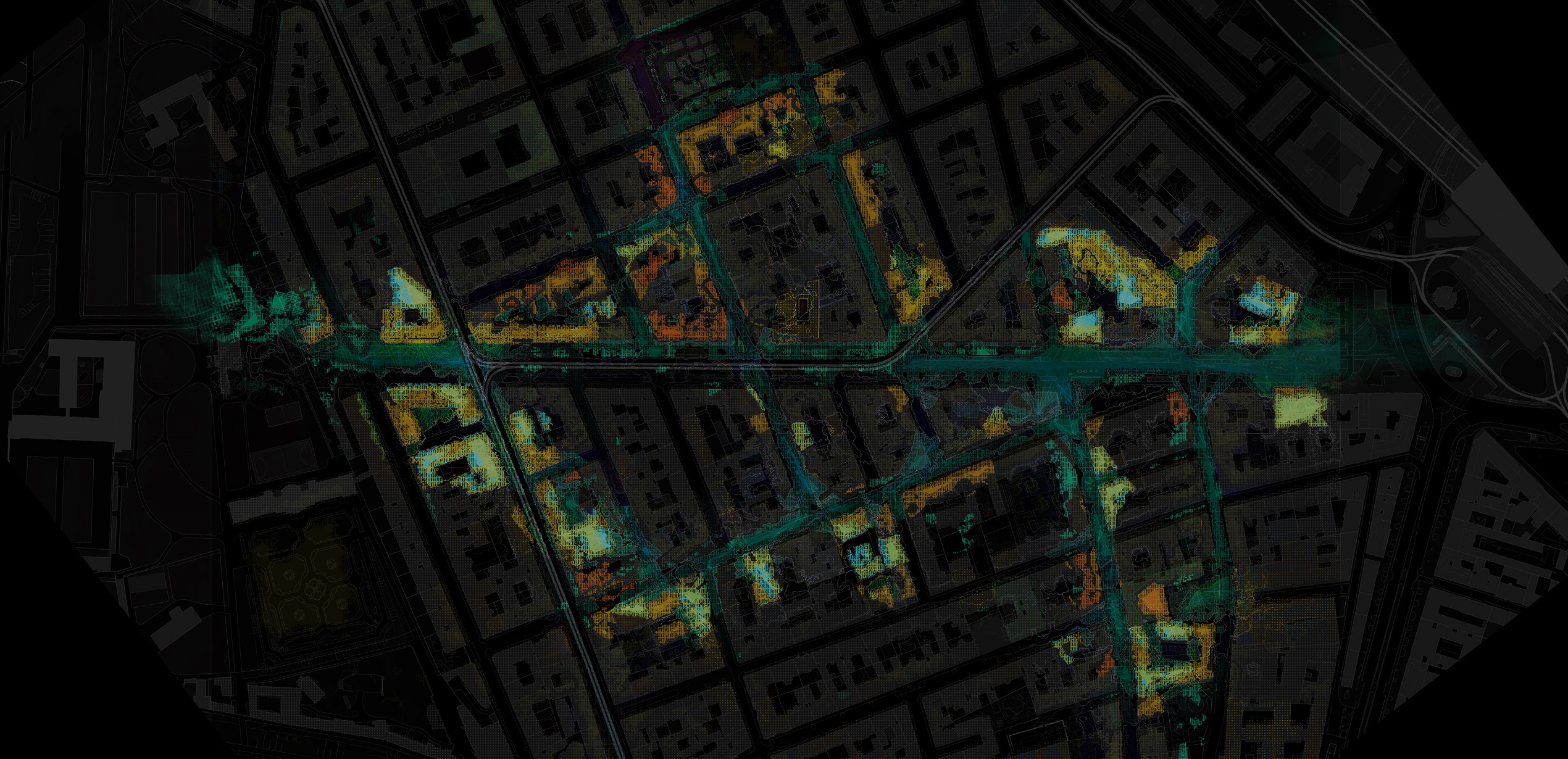
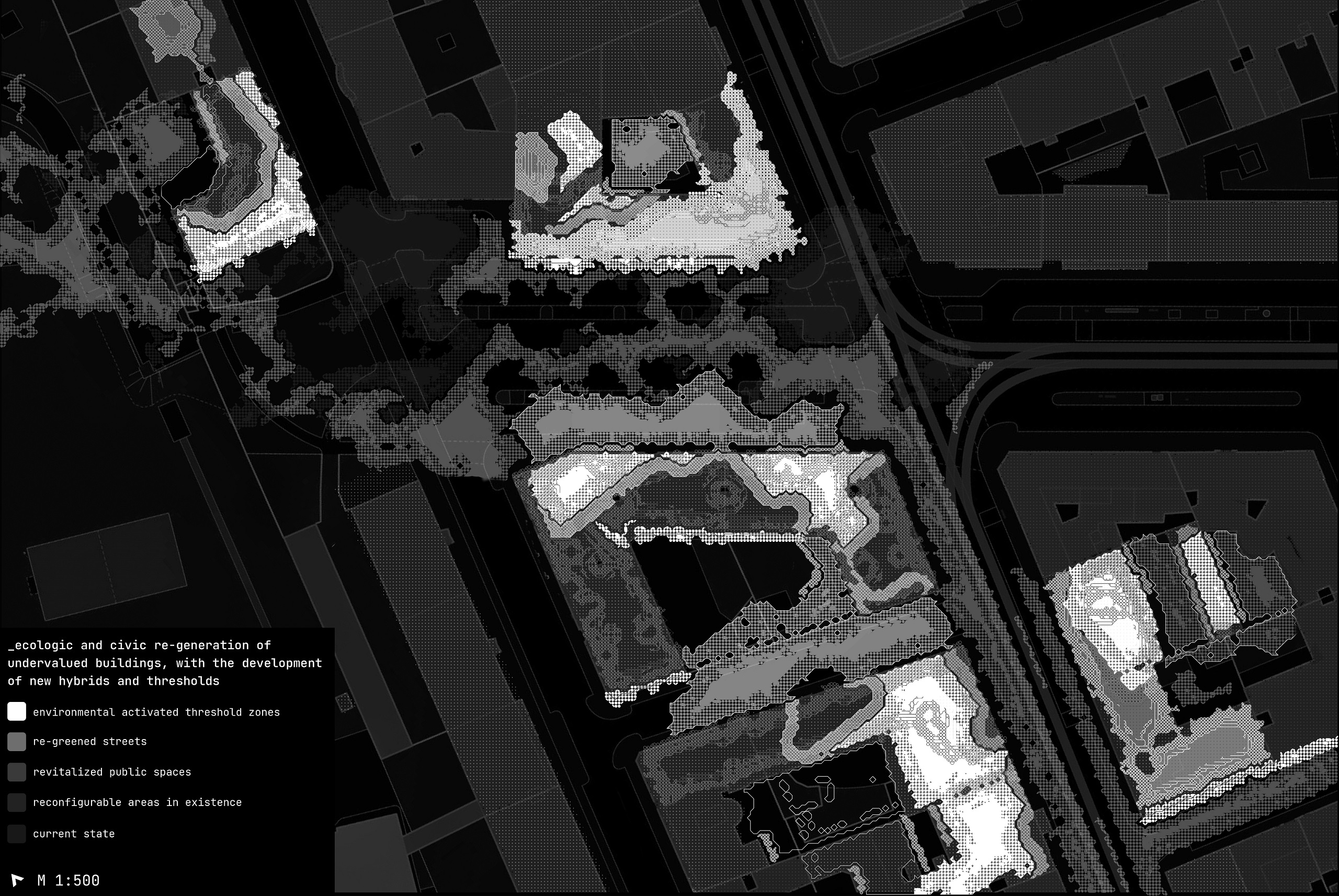
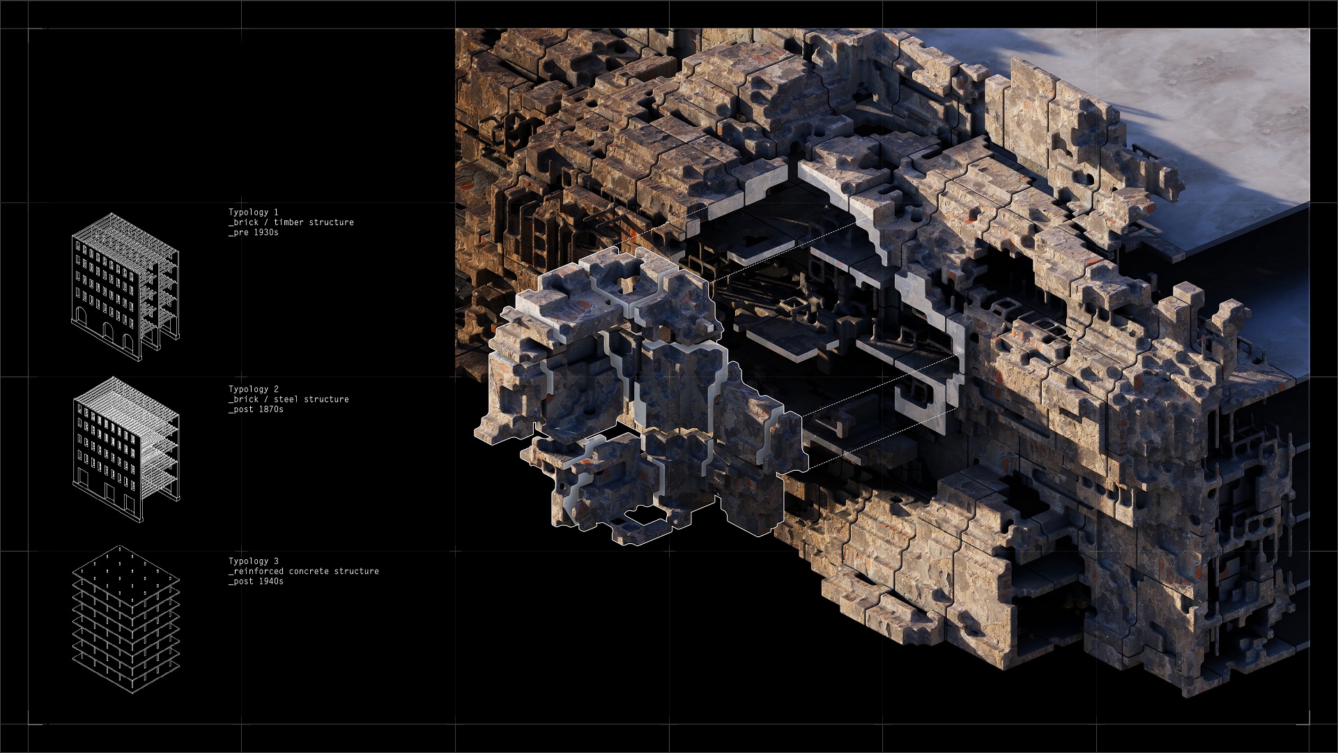
District-wide data mappings expose undervalued areas for civic and ecologic regeneration. These activated zones contain building extensions, r
evitalized public spaces and threshold zones, allowing a reconfiguration of the area.
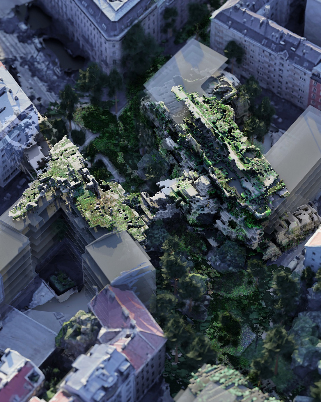
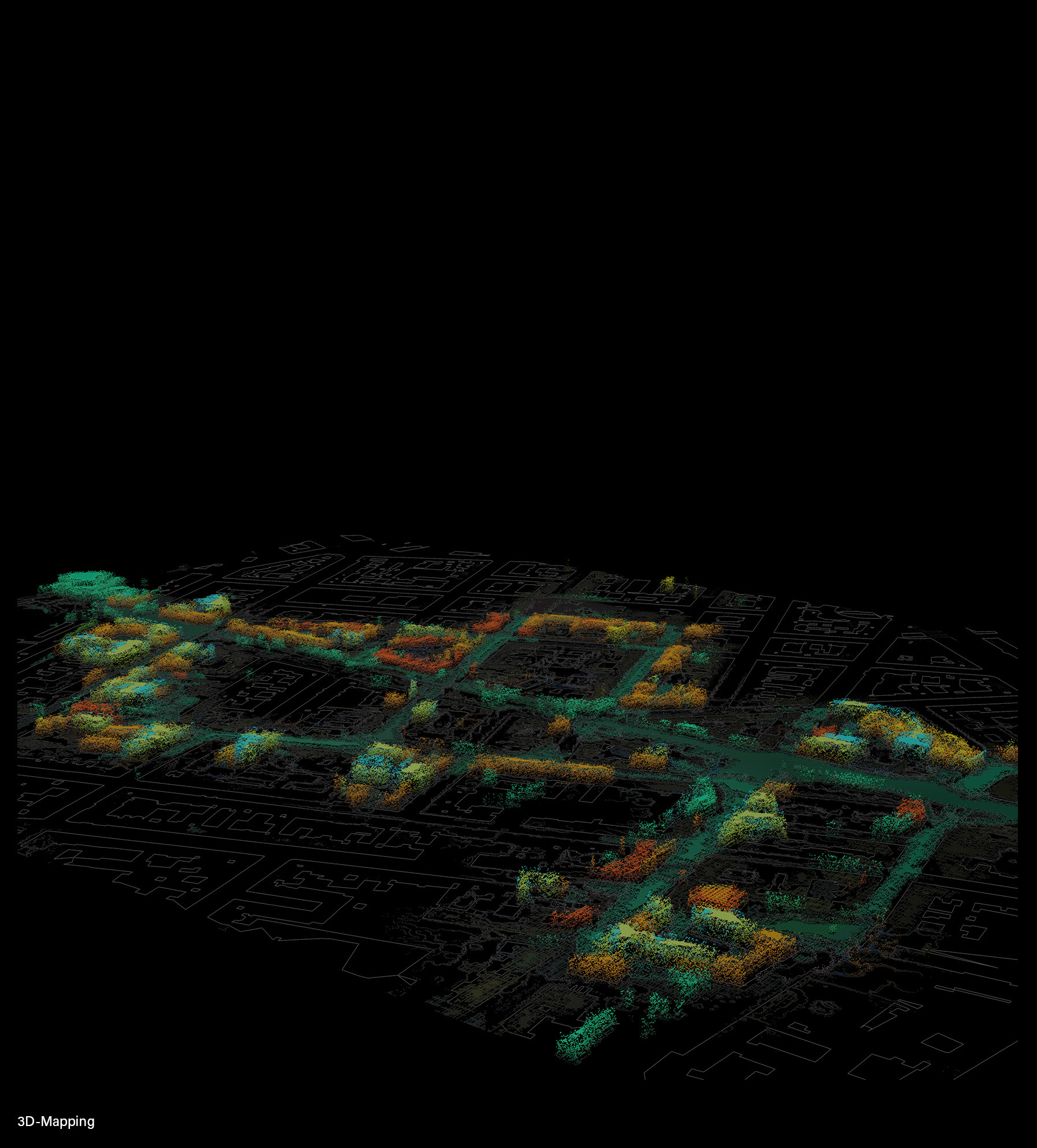
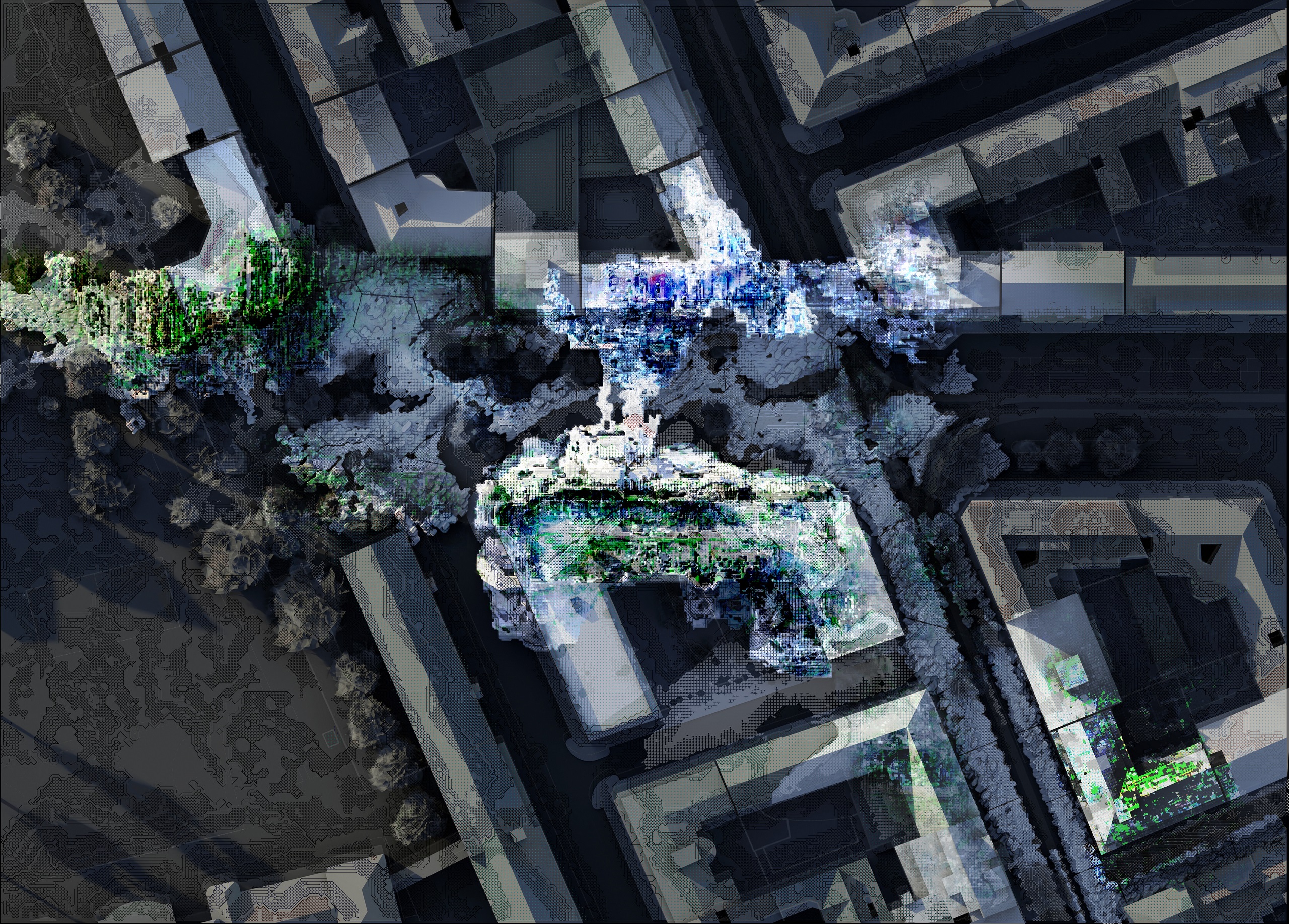
Utilizing Image-to-Image Machine Learning, those areas are ultimately dreamt into threedimensional structures responsive to their surroundings. The resolution of detail speaks to the grade of information, resulting in specific, contextualized aggregations.
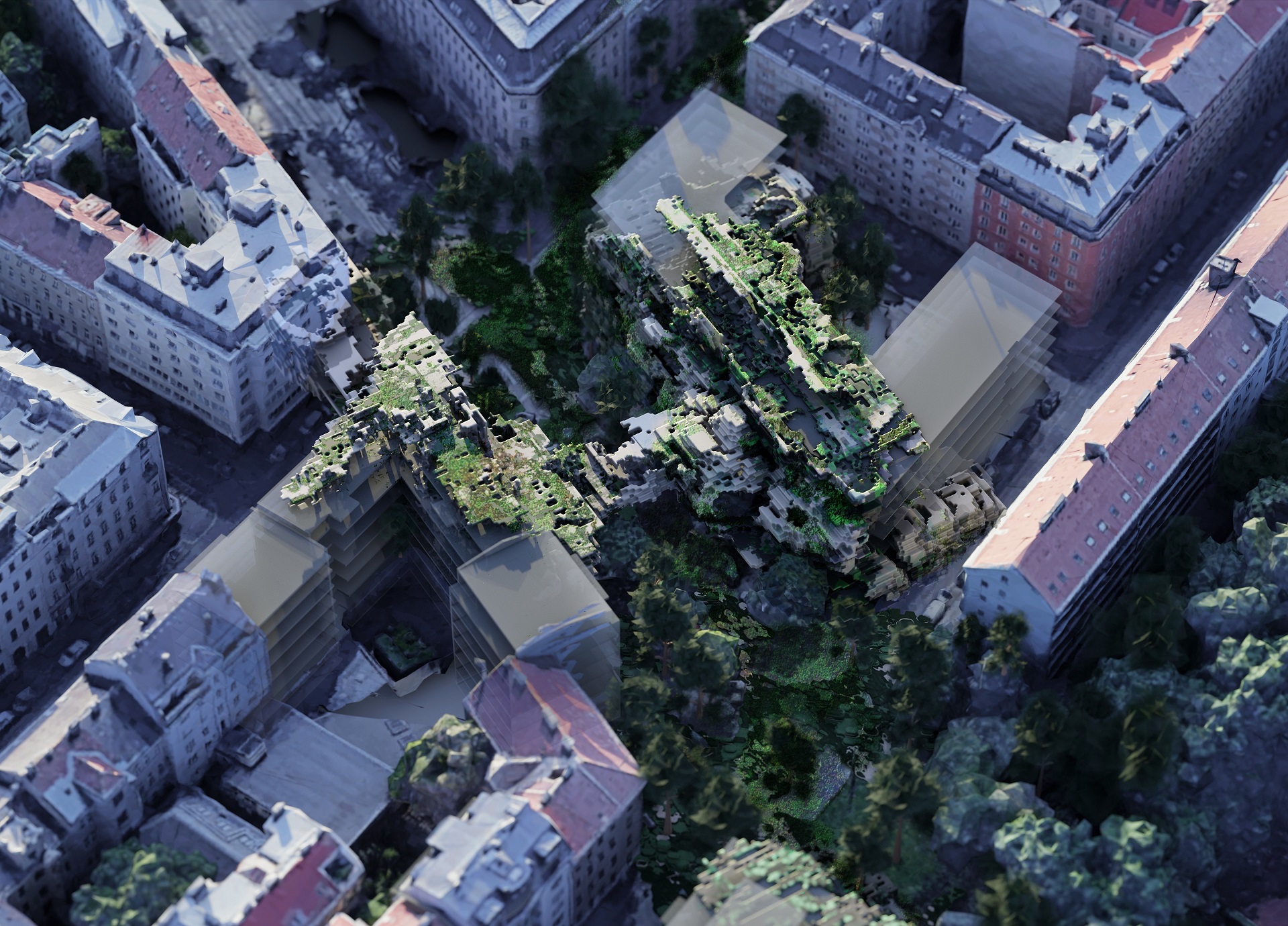
Following the Urban Cliff Hypothesis, the structures act as “reefs” for an advancing urban ecology: The heterogenous features of cliffs such as crevices, ledges, and overhangs, create a mosaic of microhabitats capable of sustaining diverse plant life and promoting ecological complexity. Over time, life sediments within the architetcure, turninf it into an urban ecosystem itself.
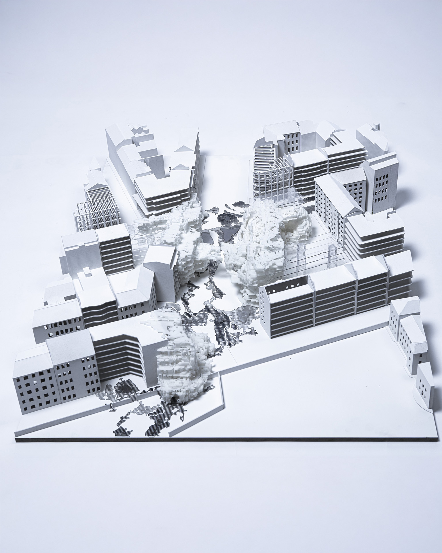
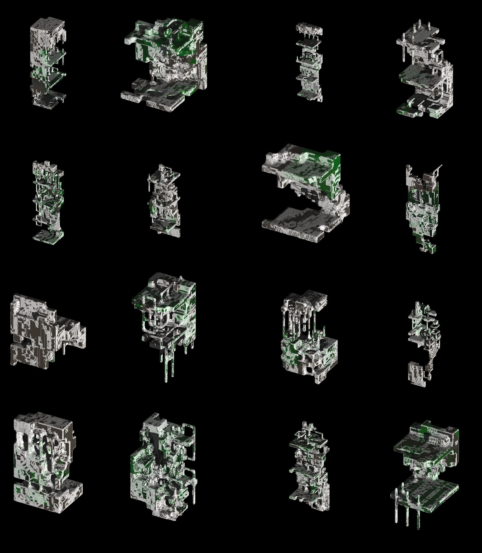
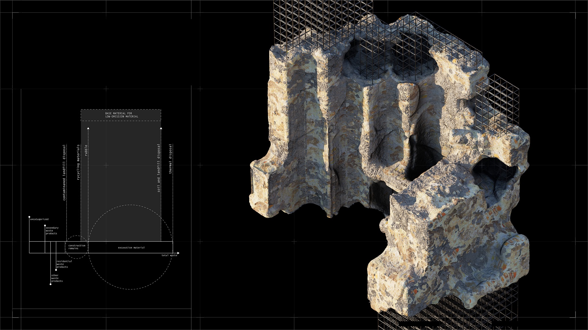
Investigating novel material strategies, the proposal investigates LC3 (Limestone Calcinated Clay Cement) as low-emission building material that can be sourced locally.
The Modules can be assembled in prefabricated units cast in modular formwork, allowing for monomaterialistic crosssections in respective parts. In addition to the already defined ecologic zones, the crevasses emerging from the weathering of material allow for the inhabitation by natural species. Through the curved surface, the microclimate is lowered in the summer by better evapotranspiration.
This can be leveraged to create building-integrated habitats supporting biodiversity. Geologically and biologically inspired textures and forms can create heterogenous microtopographies and -climates fostering plant growth. On a greater timescale, the clay and limestone further decay, exposing the reinforcements for further sedimentation. The buildings become ruins, acting as artificial reefs for natural agents.
District-wide data mappings expose undervalued areas for civic and ecologic regeneration. These activated zones contain building extensions, r evitalized public spaces and threshold zones, allowing a reconfiguration of the area.
Utilizing Image-to-Image Machine Learning, those areas are ultimately dreamt into threedimensional structures responsive to their surroundings. The resolution of detail speaks to the grade of information, resulting in specific, contextualized aggregations.
Following the Urban Cliff Hypothesis, the structures act as “reefs” for an advancing urban ecology: The heterogenous features of cliffs such as crevices, ledges, and overhangs, create a mosaic of microhabitats capable of sustaining diverse plant life and promoting ecological complexity. Over time, life sediments within the architetcure, turninf it into an urban ecosystem itself.
Investigating novel material strategies, the proposal investigates LC3 (Limestone Calcinated Clay Cement) as low-emission building material that can be sourced locally.
The Modules can be assembled in prefabricated units cast in modular formwork, allowing for monomaterialistic crosssections in respective parts. In addition to the already defined ecologic zones, the crevasses emerging from the weathering of material allow for the inhabitation by natural species. Through the curved surface, the microclimate is lowered in the summer by better evapotranspiration.
This can be leveraged to create building-integrated habitats supporting biodiversity. Geologically and biologically inspired textures and forms can create heterogenous microtopographies and -climates fostering plant growth. On a greater timescale, the clay and limestone further decay, exposing the reinforcements for further sedimentation. The buildings become ruins, acting as artificial reefs for natural agents.
![Render]()
![Physical Model, 1:200]()
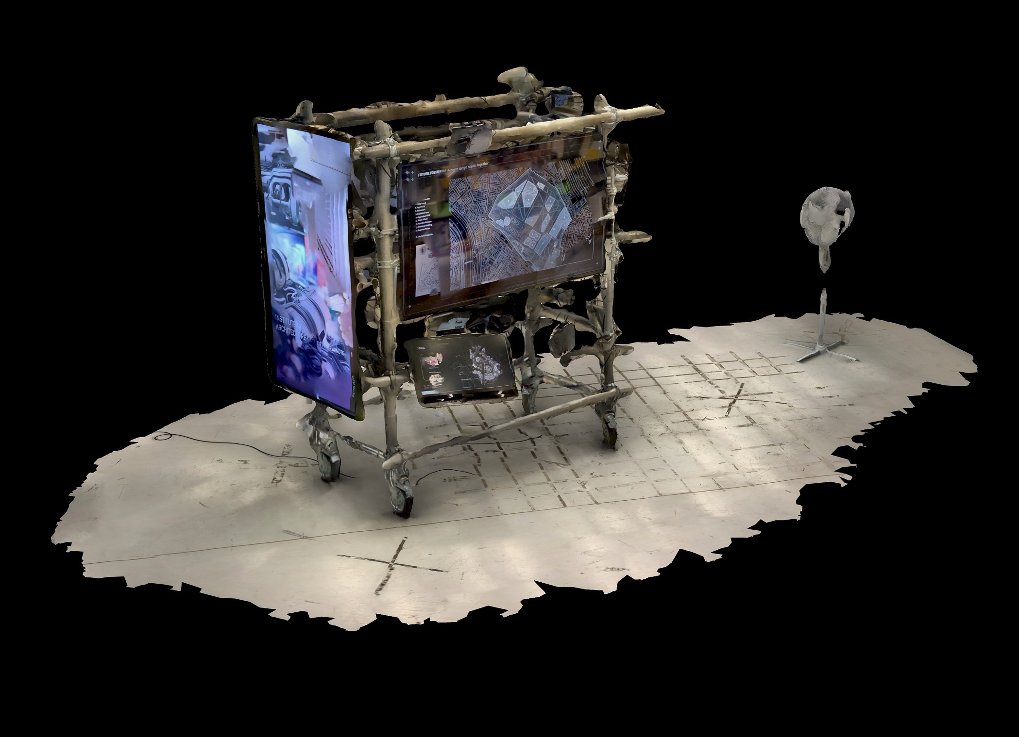
![Information Float @Angewandte Festival 2022]()
![Physical Model, 1:200]()
︎︎︎︎︎︎︎︎︎